The U-boat Positional Grid System
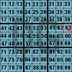
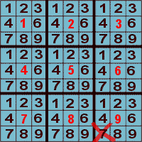
U-boats had a novel method for reporting and receiving positional information based on a grid system. This was easier to use than the conventional latitude/ longitude fix and less liable to error in transmission. Each area of the world was divided into sectors which were given a 2 letter designation. For example, the sinking of the Port Hunter was reported as grid reference DG6397, referring to the sector designated DG on the main chart (below: left). Each sector was divided into a 3x3 grid which was further divided into another 3x3 grid to produce 81 sub-sectors which were given a logical 2 digit number (below: upper right). Thus, the position of the Port Hunter is seen as DG63. The sub-sectors were similarly further divided (below: lower right) to identify the final position of DG6397.
|
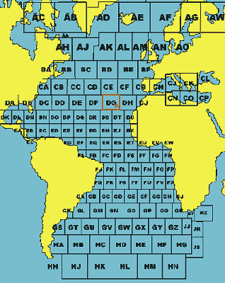
Detail of Sector DG
(X=DG63)